
Turkey for backpackers
You are already familiar with the Ukrainian Carpathians and now you are going to Turkey. Why is Turkey worth your attention? What will you find there? What will you be surprised by? And what should you be prepared for?
Why Turkey?
Firstly, Turkey is a diversity of nature. “Yedi iklim,” the Turks say. They say there are seven different climates in Turkey. There are at least four seas (if we don't distinguish the Thracian, Icarian, and Cretan Seas from the Aegean, and the Levantine Sea from the Mediterranean). There are large lakes (somewhat smaller than the Great American and Great African lakes, but still). There are deserts and glaciers; there are two-thousand-year-old plane trees and olive trees; and forests of Lebanese cedar are larger here than in Lebanon. There is one peak in Turkey over 5,000 meters (Ararat, aka Agri, aka Agir), two over 4,000 (Suphan and Cilo), and there are 59 (without Uyluk) or 60 (with Uyluk) peaks in the 3,000s. The peaks with a height of 2 to 3 thousand meters are not counted throughout Turkey: Turks half-jokingly say that there are 2 to 3 thousand such mountains.
Secondly, Turkey is a strange combination of civilization and the frontline. On the one hand, there are material monuments (including monumental ones) dating back even 8,000 years. On the other hand, there is still much unexplored and untrodden in the sea, in the mountains, and underground. And between these two extremes live almost 90 million Turks, who sell entrance tickets to ancient ruins and graze sheep and grow oranges there. They also control the Black Sea straits, sell Ukraine drones, restore Turkish order in Syria, and build a spaceport in Somalia.
Thirdly, modern Turkey combines features of many cultures: French, Roman, Greek, Arabic, Persian, Turkic... In Turkish place names, we recognize Crimea, Kherson, and Donbas; in Turkish cuisine, we find Crimea, the Caucasus, and the Mediterranean; in the Turkish language, we find Bulgarian and Ukrainian words; and in the Turkish mentality, we find the classic Galician approach. And the result of this synthesis is not an American melting pot, but something original, beautiful, and worthy of attention.
And finally, Turkey is close. Even when there are no flights from Lviv, you can get to Istanbul by car or bus in a day, and Antalya in a day and a half. Well, or by plane from Bucharest or Krakow - it will be very fast. Fast and inexpensive.

If to Turkey, where exactly?
Turkey is vast and diverse; seeing it all would take many years, but where to start?
The most popular tourist destination in Turkey is undoubtedly Istanbul, a 12-million-strong metropolis with a two-thousand-year history. The Bosphorus, the Sea of Marmara and the Black Sea, museums of the Byzantine and Ottoman eras; bridges, tunnels and a modern airport... There are two drawbacks: (1) it's cold in winter by Turkish standards, and (2) there are no mountains in Istanbul. And kalabalık - that is, too many people for a vacation. As for my taste, Istanbul is a great connecting hub; you can spend at least two hours or even two days here, but I would rather not spend my vacation there.
The closest mountain range to Istanbul is Uludag. Its greatest height is: 2543 meters above sea level. With its lake landscapes and ski resorts, Uludag is a bit like our Svydovets; but it is higher (with higher peaks, mountain lakes, and surrounding infrastructure). In fact, infrastructure is an important advantage of Uludag: from Istanbul, we took a bus to Bursa, then a cable car to the mountain hotels, and now we're at 1800. What's left to the top? And the summit is an honest two and a half thousand meters;) In addition to the lakes, the Marmara Sea is visible from the top in clear weather, and if you are very lucky, the Black Sea. The main disadvantages are: (1) Uludag is small: the national park is only 20 km long, and together with the adjacent mountains it is more like 60; and (2) the sea is only visible from Uludag, but it is a long way to walk down the mountain to the beach. And the Sea of Marmara is not the warmest or most transparent in Turkey.
If we want mountains and sea in one bottle, and the sea to be warm, then we can choose from only three major positions: Western Taurus (Batı Toroslar), Central Taurus (Orta Toroslar), and the Light Mountains (Nur Dağları). Moreover, Nur Dağları is Hatay, which recently suffered from an earthquake and, moreover, until recently was completely non-touristy because of the wars in neighboring Syria. Perhaps in a year or two or three the situation there will return to normal; for now, let's look to the west.
The seaside areas of the Central Taurus are known as Geyik Dağları (Deer Mountains), Akçalı Dağları (Blond Thorny Mountains or Maple Mountains or Poplar Mountains or Copper Money Mountains), and Gıden Gelmez (literally, Gone-and-Not-Come). There are resorts, asphalt, civilization in a narrow strip above the Mediterranean coast, and above that are wild mountains, not very high (the highest peak is 2805 meters), but heavily karsted and even hyperkarsted. Don't expect restaurants and lodges there; even the path from point A to point B can be a problem. However, if you want to climb vertical caves with nylon near the warm sea, the area is quite OK.
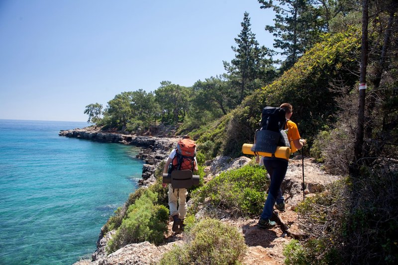
And in the nomination “mountains plus warm sea”, the Western Taurus, also known as Batı Toroslar, remains in the running after the elimination of the rest of the competitors. All the highest and perhaps all the most interesting mountains of the Western Taurus are concentrated on the Lycian Peninsula (we often see its other name on Turkish maps: Teke Yarımadası = Goat Peninsula). It is here that the impeccable three-thousand meter high Kızlarsivrisi and the “dubious three-thousand meter high” Uyluk Tepesi rise. It is here that the lights of the Yanartaş Chimera have been burning for three thousand years. It is here that the best apples and oranges in all of Turkey are grown. It is here that the largest fish farms in the Turkish Mediterranean and the capital of Turkish diving are located. It is here that the sea border is closest to the Turkish coast. And it is here that the level of cultivation of the strip between the mountains and the sea allows you to enjoy nature every day for a week or two - and at the same time, every time you spend the night in comfortable conditions of campsites and pensions.
Cultural trails
In contrast to the coastal ranges of the Central Taurus (which remains relatively wild), the first marked trail appeared on the Western Taurus 25 years ago; and since then, work on marking and improving the hiking trails has continued to this day. These works are coordinated by the organization Kültür Rotaları Derneği, headquartered in Antalya and founded by Kate Clow, the Englishwoman who started Turkish hiking as a cultural phenomenon.
There are three main trails in the area we are interested in: Lycian, Carian, and St. Paul's Trail, or two of them, because in 2021 Kate Clow walked and marked the bridge between the St. Paul's Trail and the Lycian Trail, and so some people now consider them a single route.
These are quite long routes. The classic section of the Lycian Trail is 540 km long, and with the junction to the St. Paul's Trail (if that junction is considered a continuation of the Lycian Trail), it is 710 km long. The St. Paul's Trail (without the bridge) is 500 km long. Karijka is 800 km. This is if we do not count local branches and variations such as the Fethiye trails, St. Nicholas trails, etc. It is clear that it is impossible to cram all three into one standard vacation. So what to choose?
Since we agreed to look for “mountains + sea,” we'll postpone St. Paul's a bit, because on that trail the sea is only in Antalya, and not even on the route itself. And there is no sea on the St. Paul's trail itself. There are rivers, lakes and reservoirs, but no sea. I would go to St. Paul's in June, when it is already 40+ degrees at sea, and only 34 degrees on the beaches of the mountainous Lake Egirdir.
On the contrary, Kariyka is interesting in the cool season. There are no high peaks on Kariyka, and therefore no snow, even in January and February. On the contrary, there is plenty of sea in all seasons and from all sides. The Karayka is the most seaside of all the cultural trails in Turkey. But even by Turkish standards, the Karayık is relatively difficult to supply with drinking water. Five years ago, it was severely damaged by forest fires. But even after that, you can plan and walk a very beautiful route for a week and a half along the Kariyska.
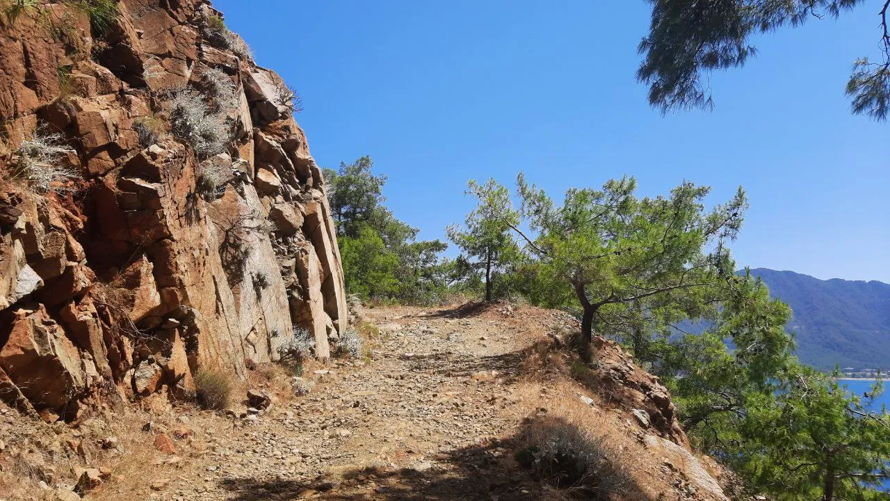
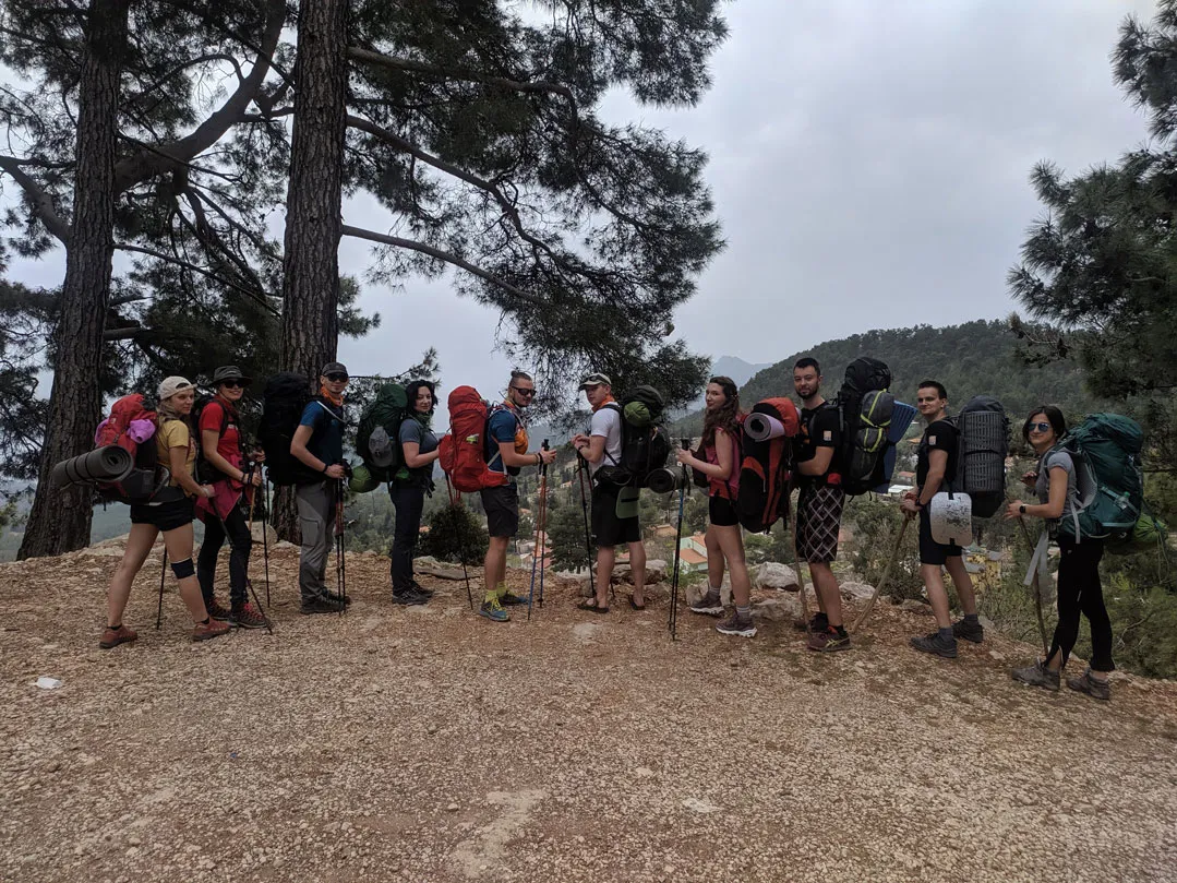
And finally, Lycian. This is historically the first of Turkey's cultural routes. It was from here, from Lycian, that the history of mass hiking in Turkey began in 1999. It was here that trekkers and backpackers from all over the world came. And it was here that the Turks began to realize that a marked tourist path through your land is not only fun, but also a lot of money. Over the past 25 years, hundreds of campsites, guesthouses, restaurants, and cafes have opened and are now operating on Likyika. Comfortable hiking is possible right here, on the Likiyka.
What does Likyka consist of and what is on it?
The Lycian Way is usually divided into three parts: Western, Central, and Eastern. (Now there is also the Jumper to St. Paul's - but it is far from the sea, so let's go back to the classics).
Western Lycia - from Fethiye to Kash. In the years when there were flights to Dalaman from Lviv and Kyiv, it was the most popular part of the Lycian Way among Ukrainian tourists. In Western Lycia, there is the top of Babadağ (Babadağ = Father Mountain) - 1911 meters; there is a large turtle beach in Patara; there is a unique feature - the Valley of Butterflies (Kelebek Vadisi).
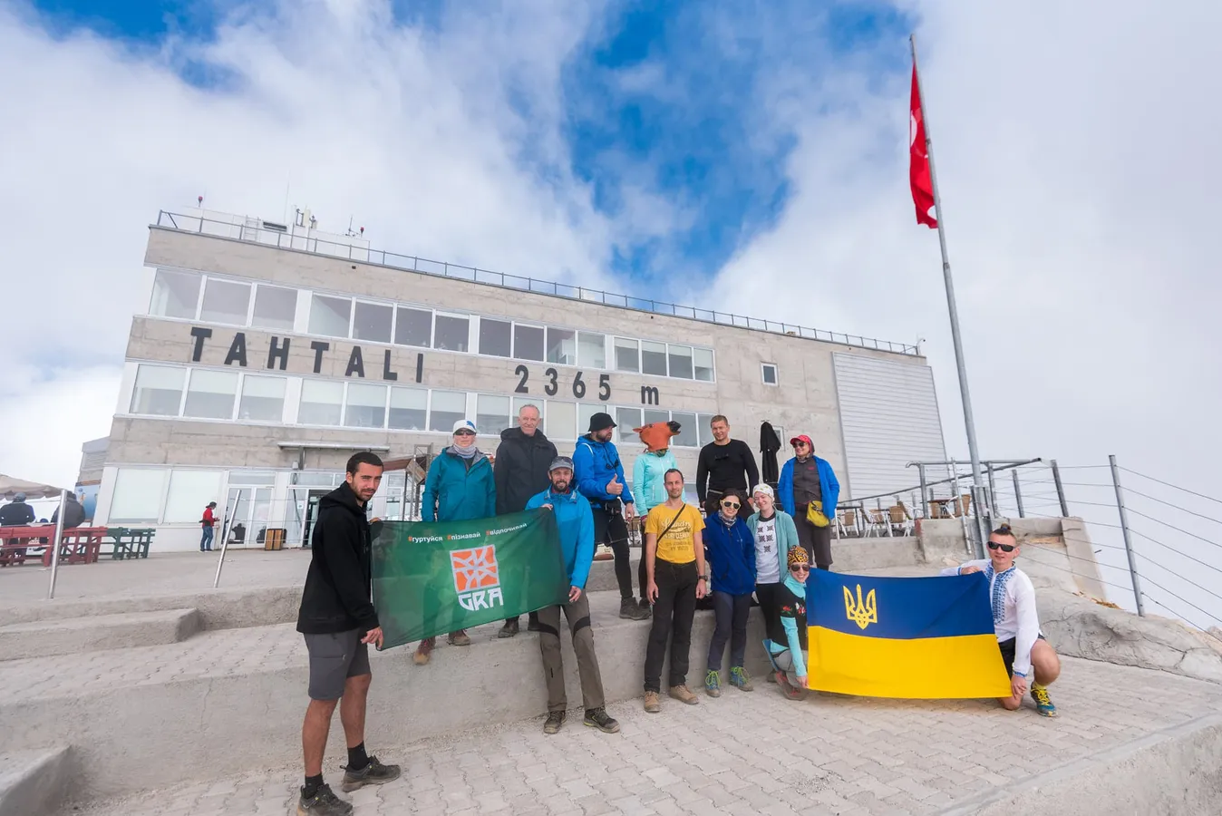
Eastern Lycian - from Finike to Antalya (or to Goykbair). It is also a popular section, and nowadays it is more convenient in terms of logistics. There is the highest peak of the entire Lycian, Tahtalı (Tahtalı = Bed Mountain: it really looks like a bed with a featherbed and a pillow if you look from Finike in winter), 2366 meters above sea level, i.e. three hundred meters higher than Hoverla. There is a second large turtle beach here, Çıralı. And it has its own unique feature - the lights of Yanartaş.
Central Lycia is a bit unlucky, or lucky, depending on the point of view, compared to Western and Eastern Lycia. The nuance is that it is easier to drive to many of the attractions of the Central Walk than to walk. In addition, few people start walking the Likiyka from its central section. And when the path is not used much, it becomes overgrown. So the Central Likyka is gradually overgrown, and it is overgrown with thorns. So if you're going to go to the Central one, you should be equipped accordingly.
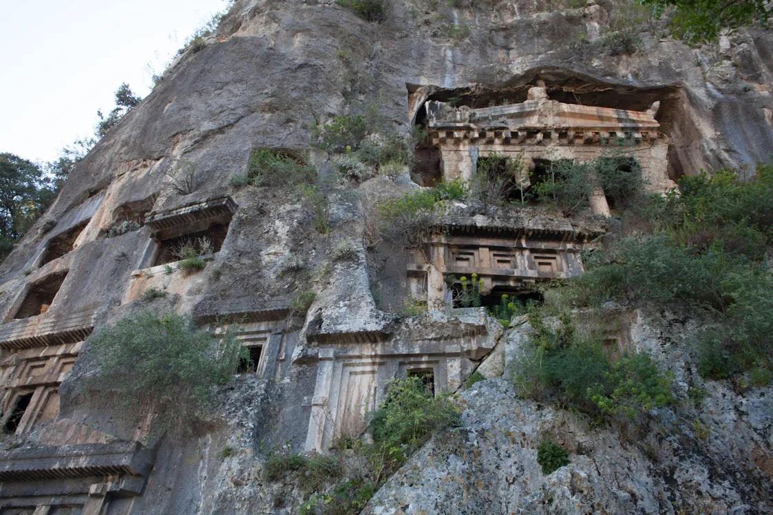
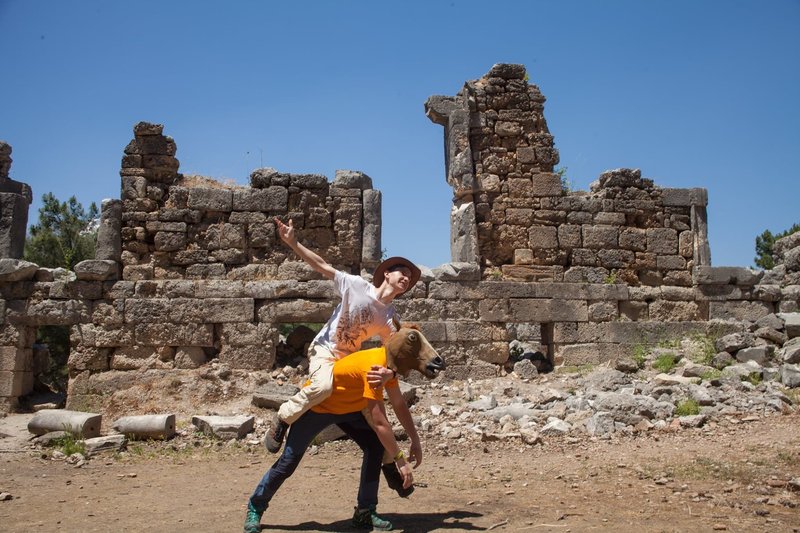
What is there on the whole Likiyka? There are many historical sites. In most cases, these are ruins: ancient Greek, Byzantine, Genoese... Some are museumized, some are slowly falling apart, some are still used for their intended purpose.
What else is there here? Canyons. On the Central Canyon, it's Demre-Chai: it's just a road, with views, but no entertainment. On the Eastern side, there is Göynük: there is a cascade of ponds, there are excursions on an inflatable boat (which for some reason is called rafting), there is swimming in a mountain river in a wetsuit (which is called canyoning here), and there are zip lines. There are no interesting canyons in Western Lycia itself (unless you count the Butterfly Valley as a canyon); however, there is the famous Saklıkent Canyon 15 km away.
How and when to get to Likyka?
I go there by bus. Lviv - Antalya, Kyiv - Antalya, Odesa - Antalya... There are direct bus services now, and those buses arrive exactly where the planes from Krakow do: at Antalya International Airport. So, if someone in your company is traveling from Ukraine and someone from Europe, it is convenient to meet there.
The track of the Lycian Trail is adequately shown by popular smartphone navigation apps, such as OsmAnd, MapyCz... There are also markings on the trail, but remember that any mapping information (paper, electronic, etc.) tends to become outdated and irrelevant. For example, in Eastern Licia, some locals dig up a trail that interferes with their lives - or vice versa: they build a fence to a neighbor's house so that tourists' money doesn't flow to that neighbor; and in 2024, false markings appeared in the Chimera area, leading to a dangerous area.
The water in Likytsia is better than in the desert, but worse than in our Chornohora. In terms of seasons, it's better in spring than in fall. Summer and winter are somewhere in between.
As for the air temperature, I think the most comfortable conditions are from April to mid-May and from mid-September to mid-November. In summer, there can be a lot of people on the trail, and on low-lying sections it can be too hot under the backpack. So I would not put off Likiyka until summer, but go in the spring.
Around Likiyka
When you have already walked the Lycian hiking route, what else can you find around you?
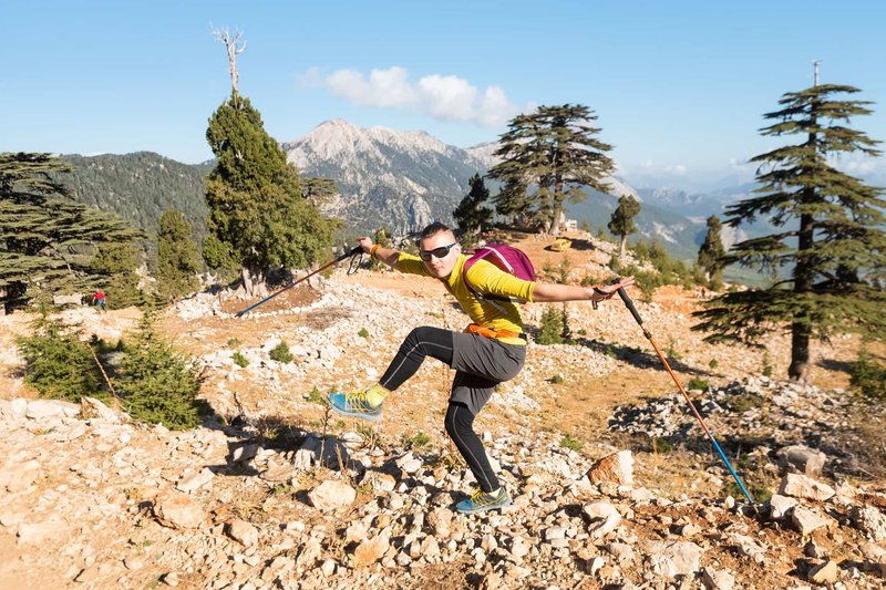
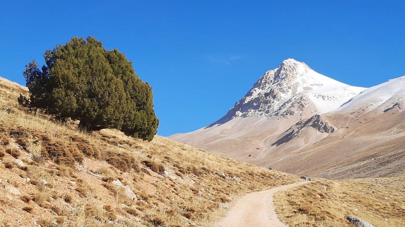
- High Beydağlar (Beydağlar = Rich Mountains). The highest peak of this massif is the honest three-thousand meter high Kızlarsivrisi, 3070 meters. You don't need crampons up there, everything is done with your feet. When there is no snow (i.e., from July to November), you can even go without cats. In addition to the three-thousander, there are fifty peaks of 2500+. In addition to the peaks, there is a protected forest of Lebanese cedars and tall junipers. There are karst valleys. There are caves. What is missing is adequate maps of the High Beidaglar. Neither electronic nor paper. The ones I've seen show the relief even more or less, the road network is fragmented, and the water sources are very approximate, not to say fantastic. You need a guide who has that map in his gadget or in his head.
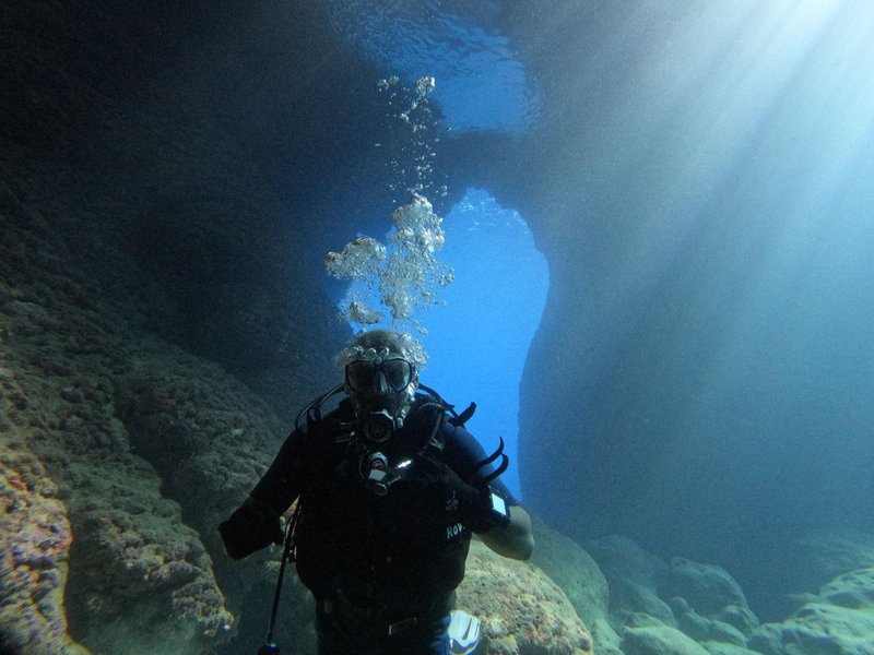
- The Mediterranean Sea. As the Turks say, it is Ak Deniz, literally the White Sea. White because it is sunny, clear and warm. The lowest temperature of sea water here is 17 degrees (and in Kashi 18), the highest is 31. In April, it will be about 20; in October, 25. There are beaches for every taste, style, service and budget. There are boat trips, diving. The “capital of Turkish diving” - Kash - is right here on Lycian: the season there lasts 12 months a year. And there are good dive centers in many towns along this coast: in Finik, Adrasan, Kemer.
- Ancient cities and historical museums. There are a lot of these in Lycia. The most promoted, popular, and populist ones are Mira and the Church of St. Nicholas in Demre. It's expensive but interesting... or, more accurately, interesting but expensive. And the Church of St. Nicholas is closely surrounded by Moscow comrades, with an icon center and a stream of Russian pilgrims. If you need something else, then in Demre there is also the Museum of Lycian Civilization at the Andriake settlement; in Finike there is Limira, where the river flows along an ancient street; Arikanda, which was already a resort when Turkey did not exist.
The Lycian trail is a good touchstone. When you have walked a good part of Lycia, you already understand what you want more and what you want less of from the Turkish assortment. Those who want fewer mountains should probably try Kariyka next time. If you want higher mountains - High Beydaglar, Akdaglar, Aladaglar... If you want large lakes - the St. Paul's Trail. If you want small but very high lakes - Uludag. And if you prefer the sea to any lake, you can come here again, to the Lycian Peninsula. Because the sea here is warm, clear, and interesting!
Lycian Way - Turkey
- 03.04.2025 - 12.04.2025

Author

Similar articles
